OAKVILLE, ON/CNW/ – Mounting snow banks, marathon shoveling sessions, icy windshields, delayed commutes. While we all know what to expect from winter by now, Canadians could be in store for a particularly stormy season, according to the Weather Network’s winter forecast.
“Due to a weak to moderate La Niña, this winter is shaping up to have two distinct personalities – while Canadians should brace themselves for periods of high-impact weather and an impressive amount of snowfall, the good news is we should get a mid-winter break,” explained Chris Scott, chief meteorologist at the Weather Network. “As a whole, Canadians should expect a wild ride from start to finish. It’s safe to say we’ll all be participating in winter this year.”
READ MORE: 2016 winter forecast
Here’s a more detailed look at the conditions expected across the country this winter:
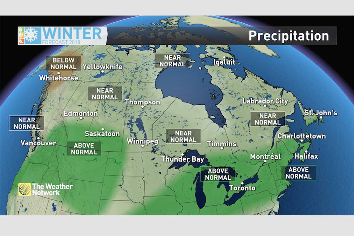
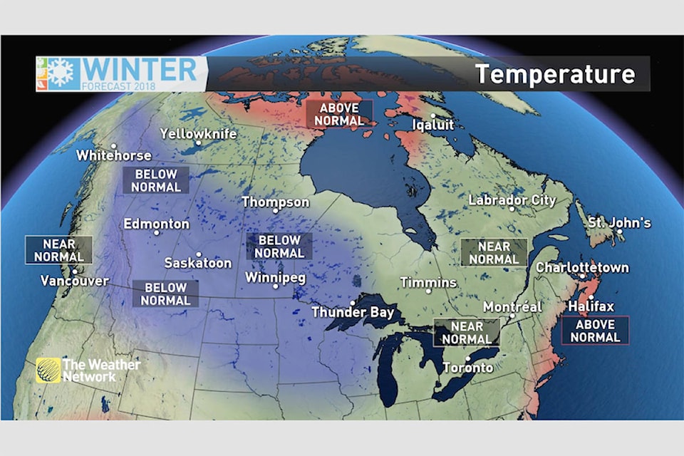
• British Columbia – Colder than normal temperatures are expected across the eastern half of the province with near normal temperatures near the coast. The province will see an abundance of wintry weather with excellent ski conditions for much of the season, but this winter will not be as persistent or as severe as it was last year, especially for the south coast of B.C.
• The Prairies – The Prairies will experience the harshest winter weather in the country with below normal temperatures and above normal snowfall expected for much of the region, especially across the south. However, the frigid pattern is expected to relax at times and above normal snowfall is good news for areas that experienced drought conditions during the summer.
• Ontario and Quebec – A classic Canadian winter is expected for this region with an active storm track bringing above average snowfall across central and southern regions. There is also the threat for freezing rain at times across the south. The cold will be the bigger story across northwestern Ontario with colder than normal temperatures expected. However, the pattern will relax at times.
• Atlantic Canada – A classic Canadian winter is expected with near to above normal temperatures for much of the region and above normal precipitation. Temperatures should still be cold enough for an abundance of snow and ice, but periods of milder weather and rain will keep the snowbanks from getting as high as they did during the infamous winter of 2014-2015.
• Northern Canada – Near normal to below normal temperatures are expected for Whitehorse and Yellowknife with near to above normal temperature for Iqaluit. Milder than normal temperatures are expected for most of Nunavut. Below normal precipitation is expected for parts of the Yukon.
With an abundance of snowfall and storms expected across the country, Canadians should pay extra close attention to the daily forecast as winter weather conditions can develop rapidly. Canadians can prepare for changeable weather patterns by visiting www.theweathernetwork.com or by downloading The Weather Network App and creating an account for personalized and up to the minute forecast information.