By Times Staff
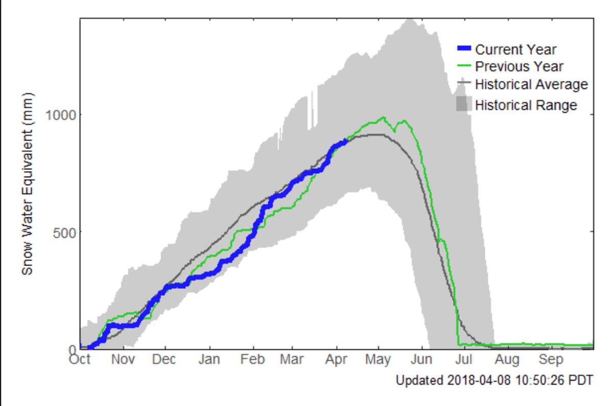
With a near normal snowpack (105 per cent as of March 1), it appears the North Thompson basin is unlikely to face serious flooding this spring.
However, the snowpacks in Upper Fraser West, Okanagan, Similkameen, Boundary and Skagit are all well above normal (>130 per cent), according to a bulletin from B.C. River Forecast Centre released Monday.
READ MORE: River Forecast Centre bulletin
Snowpacks in the Kootenays are also considered high (>120 per cent).
Nearly 80 per cent of the annual B.C. snowpack typically accumulates by early March, the bulletin states.
Seasonal forecasts (March to May) from Environment and Climate Change Canada indicate an increased likelihood of normal temperatures across most of British Columbia. Short to medium term forecasts suggest some warming through the end of the current week, and a transition to cooler and wetter weather into the middle of the month.
Snow pack is one element of seasonal flood risk during BC’s freshet season. Weather patterns during the snow melt season play a critical role in whether or not flooding occurs. Intense or prolonged rainfall and extreme temperatures are important factors that can lead to flooding, even for areas with a near normal snow pack.
The River Forecast Centre will provide an updated seasonal flood risk forecast in its April 1, 2018 bulletin, which is scheduled for release on April 9.
newsroom@clearwatertimes.com
Like us on Facebook and follow us on Twitter