UPDATE
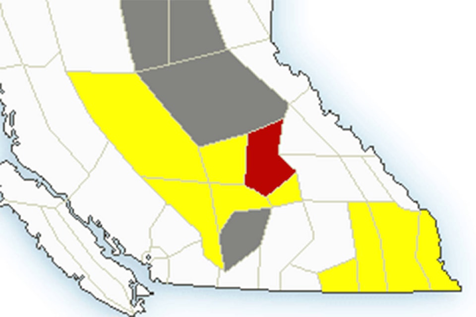
The severe thunderstorm watch for the North Thompson has been upgraded to a warning, as of 2:27 p.m. Wednesday, July 7.
“Radar indicates an area of thunderstorms midway between the North Thompson River and Adams Lake (east of Barriere),” the statement reads. “These thunderstorms are moving slowly west-northwestwards and are capable of producing nickel-sized hail.”
Special weather statements and updates can be viewed here.
EARLIER
The North Thompson is under a severe thunderstorm watch, a notice released Wednesday morning (July 7) at 10:56 a.m. from Environment Canada states.
“Conditions are favourable for the development of severe thunderstorms that may be capable of producing strong wind gusts, large hail and heavy rain,” the statement reads.
It also notes there is a slight risk of pea- to nickel-sized hail, heavy downpours of five to 15 millimetres and wind gusts of 70 kilometres per hour.
The areas of concern in the watch are the southeastern Chilcotin, including Big Bar Creek, Fraser Canyon North, Lillooet and 100 Mile House, the North Thompson and the South Thompson, including Kamloops and Shuswap.
As of late Wednesday morning, the Environment Canada forecast is calling for increased cloudiness, 60 per cent chance of showers with a risk of thunderstorms. A risk of thunderstorms is also in effect for early evening.
Areas including 100 Mile House, Cariboo, Fraser Canyon and Chilcotin, Kamloops and South Thompson are under an air quality advisement as well.
Special weather statements can be viewed here.
READ MORE: ‘We are all still reeling’: Open letter from Lytton details devastation from deadly wildfire
newsroom@clearwatertimes.com
Like us on Facebook and follow us on Twitter