People driving east along Highway 5 past Mad River might have noticed a glacier-covered mountain in the distance. I climbed that mountain over 40 years ago with four other people. Recently a friend asked about the climb. The following is based on what I told him.
The mountain is called Gold Peak on Google Earth and is located about 25 km east of Avola and 15 km southeast of Tumtum Lake.
We made the climb in August of 1981. We went in via Gold Creek, which is a tributary of Adams River. There used to be a bridge across the river just south of Gold Creek and a logging road up the creek but the bridge washed out many years ago and I don’t know if the road is still usable or even accessible.
An outdoor guide from California I knew, Craig Ballenger, and I had talked about doing the climb for at least three years. When we finally did it there were the five in the group: Craig, Susan Albert from Lumby, two young Americans named Dale and Paul Adams and me.
We left our vehicle at around 2,500’ (760m) elevation and Gold Peak is about 9,400’ (2,900m). That meant we needed to do roughly 6,000’ of elevation gain. As I recall, it was 2,000’ bushwacking, 2,000’ of rock-hopping and slide alder, and 2,000’ glacier.
On the first day we found ourselves in a box canyon. Craig rock-climbed up a difficult pitch then lowered a rope so the rest of us could get up.
We bivouacked that night on a fairly steep slope that we sort of flattened with our ice axes.
The second day we got onto the glacier. Everyone had an ice axe, a helmet and crampons. We roped up in two parties. If someone in one party fell into a crevasse, the other person or persons in the party would fall onto his or her ice axe to do a self-arrest. The second party would then do a rescue.
The crevasses were covered with snow on the flattish part of the glacier but we could see where they were by the lines of depressions. At one point a member of the group stood in the middle of one of the depressions and jumped up and down, possibly to find out if there really was a crevasse underneath. Craig got a little excited about that. Extracting someone safely from a crevasse can be difficult.
When we finally approached the summit we saw a cairn. Inside the cairn we found a tobacco tin and inside the tin was a piece of paper with the names Jim Chambers and Helen Singh, two Little Fort residents. They had climbed it the year before – meaning if Craig and I had climbed it when we first talked about it, we might have had a first ascent. Craig later came back with a different group and apparently got a first ascent on the nearby peak marked Gold S4 on Google Maps.
Coming down we were able to avoid the box canyon plus most of the slide alder and devils club that had made the ascent more challenging.
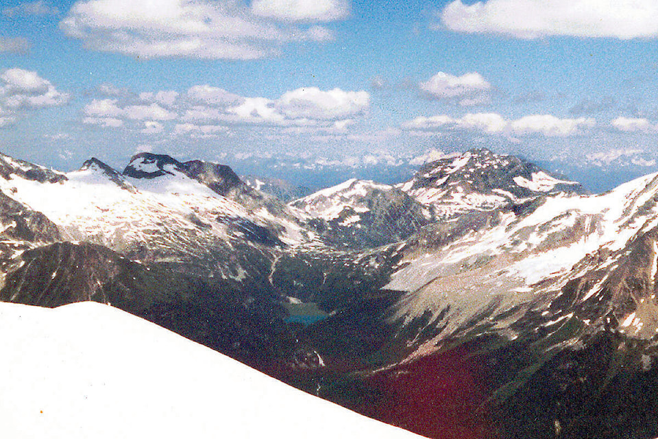
Overall, the climb was a long, hard slog rather than technically difficult. The views from the summit made it all worthwhile.
newsroom@clearwatertimes.com
Like us on Facebook and follow us on Twitter