Keith McNeill
According to B.C.’s River Forecast Centre, this year’s spring freshet for the North Thompson and Clearwater rivers peaked last weekend, with secondary peaks forecast for the middle of June.
Although the usual fields and other low-lying areas were flooded, there appears to have been no serious damage.
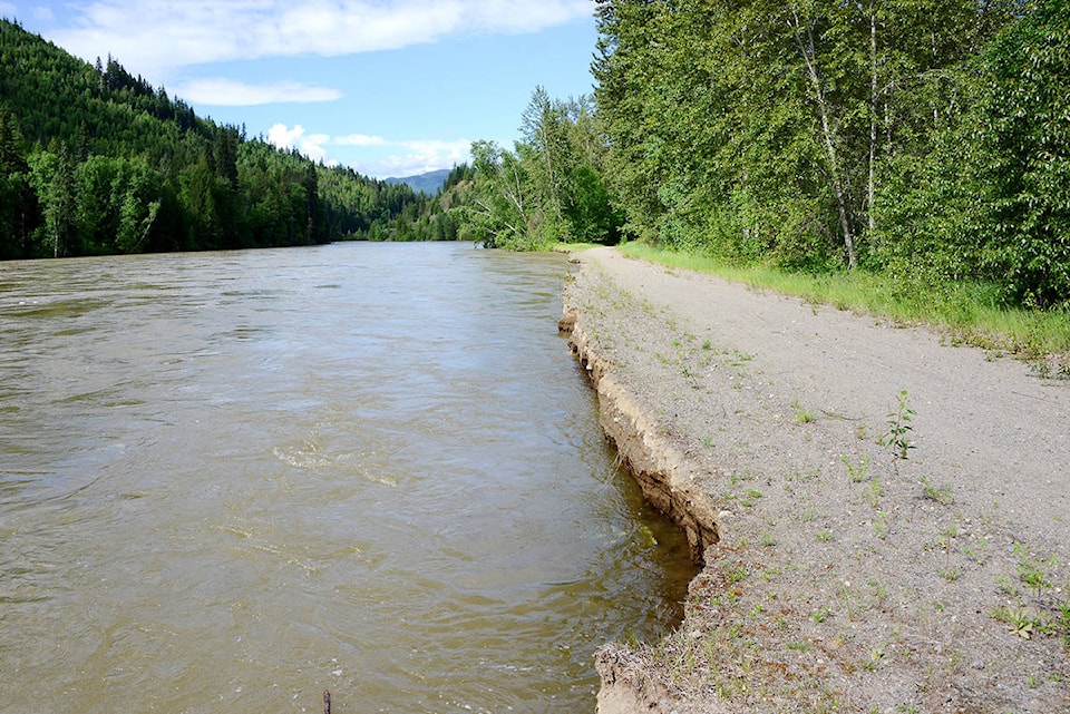
One possible exception is the road that runs next to the North Thompson River from the old planer mill site on the Flats in Clearwater to the Highway 5 bridge over the Clearwater River.
Fast-flowing water has washed away part of the road in a couple of places. The road is mostly on private land and has been closed to vehicular traffic for several years.
According to the River Forecast Centre, the North Thompson River at McLure peaked on June 2 and 3, reaching just over a 10-year return period flow.
A secondary peak forecast to occur around June 12 is forecast to reach a five-year return period flow.
The Clearwater River at Clearwater almost reached a 20-year return period flow. It is forecast to reach about the same level again on June 12 and 13.
The North Thompson River at Birch Island was at a five-year return period flow from June 1 to 3. Its secondary peak on June 12 is not expected to reach a two-year return period flow.
According to Wikipedia, return period, also known as a recurrence interval (sometimes repeat interval) is an estimate of the likelihood of an event, such as an earthquake, flood or a river discharge flow to occur.