“Back Country Closed!” I read on a Wells Gray Provincial Park sign with some dismay.
A hiking buddy from Kaslo would soon be visiting and I’d made extravagant promises about wondrous sights here. Could I still deliver?
“Lots is still open,” a bright young gal at the Information Centre assured us, “but if I haven’t marked it on your map, you cannot go there.”
Off we went under mainly blue skies on Tuesday, Sept. 5 in hopes of seeing all of these popular sites. Smoke drifted in and around as the day progressed, but stayed high.
Dawson Falls lived up to its “Little Niagara” nickname. Every cataract, dip, and rise of the oft-hidden rocky drop showed itself through the low but rushing water of the Murtle River.
A rainbow played hide and seek. Now off to such a fine start, we headed to Helmcken Falls.
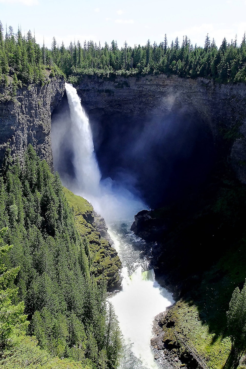
Friend Sheila was so taken aback at the huge canyon beyond the fence, she didn’t immediately see the falls.
“Wow!” she said suddenly. “That’s unbelievable,” she added as we approached the viewing platform.
Here we waited our turn to get to the best spot for seeing water pouring out into space and downwards past the huge cavern it has eroded and the smaller falls below.
“Canada’s fourth largest waterfall,” I boasted as if I had created it; Sheila snapped pictures including posters that compare its drop with Niagara’s. Looking at the board showing the winter cone, we tried to judge whether it reached a third or halfway up the chasm.
“Cafe open!” Three ducky things (mergansers?) floated in the calm water at the end of Clearwater Lake as we dined nearby. Fish jumped further away, safely out of reach as boaters are warned to stay away from the wide drop called Osprey Falls.
Speaking of fish, after a wander through the campground and across lava-laden Falls Creek, our next walk took us into Bailey’s Chute.
“Look!” erupted from the goodly group of us viewing the downward rush of water and upward leaps of large salmon. “This is a sight I’ll never forget!” smiled Sheila delightedly.
Our feet were soon taking us to the mineral springs of Ray Farm.
“It’s so peaceful,” we almost whispered to each other while viewing them and the remaining drooping buildings. “There’s less to see of those every year,” I commented sadly.
Reaching the always-changing Mushbowl once more, we drove across the Bailey Bridge marveling at the power of the Murtle River once again.
“Sometimes you cannot even see some of those rocks,” I said as we continued retracing our steps, “but it looks like it will be clear enough to check the view,” I added happily as we bounced around some of the sharp corners on our way to the top of Green Mountain.
After startling Sheila with Roland Neave’s photo of the original fire lookout (an anchored ladder), we were glad to be climbing the sturdy steps of today’s structure.
With labelled photos matching the hazy views, I pointed out places for “real” hiking.
Having saved Spahats Falls for our final stop, I was unprepared for the thin column of water falling straight down.
“Look at the arrowhead shapes within,” said Sheila, always observant. “But the immensity and layering of this canyon is almost making me dizzy!” she added taking photos of the varied designs and colors.
Even though we’d missed possible forays into Sticta Falls and Norman’s Eddy, we barely made the grocery store before closing time.
Chef John had given us a list of essentials and, with them, had supper on the table within minutes of our saluting the day with sips of chilled beverages.